Best Hikes Near Snoqualmie Pass

TRAILS CLOSE TO SEATTLE

Summer adventure near The Summit at Snoqualmie - Snow Lake Trail isn't the only spectacular trail near Seattle! There are quite a few hiking destinations nearby that make for great summer day trips. Here are ten of our favorite lesser-known hikes near The Summit.

Great Alternatives to Snow Lake Trail

Snow Lake & Franklin Falls aren't the only fantastic hikes right outside Seattle. Scroll down to find more options, and check a few new hikes off your list this summer!

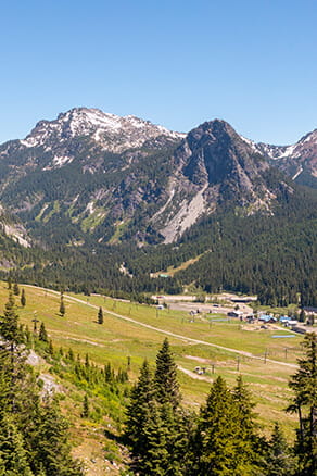
Gold Creek Trail / Alaska Lake

EXIT 54 ON I-90

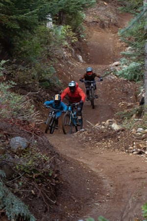
This trail can be whatever you make of it: An easy one-mile stroll around a beautiful pond, a nice walk through a forested valley, or a more rugged alpine adventure farther up the canyon.

  • distance
    1 to 14 Miles
  • vertical
    10 to 2600ft Elevation Gain
  • location
    Trailhead Coordinates: 47.410092052, -121.36448224

Lodge Lake

EXIT 52 ON I-90

Follow the PCT south from Snoqualmie Pass for about two miles and you’ll arrive at Lodge Lake, our little backyard gem. Tip: Shorten this hike by taking a scenic chairlift ride to the top of Summit West, and then link up with the trail from there!

  • distance
    3.75 Miles Round Trip
  • vertical
    950ft Elevation Gain
  • location
    Trailhead Coordinates: 47.42764673, -121.42043229

Snoqualmie Tunnel

EXIT 54 ON I-90

An old, 2.3-mile-long tunnel under Mt. Hyak used to be part of The Milwaukee Road, a railroad that ran from Chicago to Seattle. Abandoned in 1980, the tunnel now makes for an exciting hiking adventure. Just be sure to bring a headlamp! Note: Google Maps labels the tunnel at its center, where it is hundreds of feet underground. Do not attempt to access the tunnel from this point. Park at the Hyak Sno-Park to begin the hike.

  • distance
    5.3 Miles Round Trip
  • vertical
    0ft Elevation Gain
  • location
    Trailhead Coordinates: 47.39183022, -121.39100374

Mirror Lake

EXIT 62 ON I-90

Drive past Lost Lake on your way there, hike by Cottonwood Lake, and arrive at Mirror Lake! This short trail makes for a very pleasant half-day excursion and is great for families.

  • distance
    2.2 Miles Round Trip
  • vertical
    870ft Elevation Gain
  • location
    Trailhead Coordinates: 47.34791064, -121.4180235

Kendall Katwalk

EXIT 52 ON I-90

A six-mile hike northbound along the PCT leads up and out of the Commonwealth Basin and onto a beautiful section of trail carved into the cliffside. Peak elevation on this section of the trail reaches 5,400ft. (photo: Quinn Gerberding)

  • distance
    12 Miles Round Trip
  • vertical
    2600ft Elevation Gain
  • location
    Trailhead Coordinates: 47.42800010, -121.41338052

Mt. Catherine

EXIT 54 ON I-90

Short but steep, this hike is one of our backyard favorites. Mt. Catherine is located just west of Mt. Hyak (home of Summit East), and serves up great views of the Snoqualmie Pass area. The old growth forest is stunning on the way up!

  • distance
    3 Miles Round Trip
  • vertical
    1330ft Elevation Gain
  • location
    Trailhead Coordinates: 47.37035570, -121.44378533

Silver Peak

EXIT 54 ON I-90

Just across the road from Mt. Catherine is the slightly taller Silver Peak, which is the highest point in the Snoqualmie Pass area on the south side of I-90. The peak can be accessed from multiple directions, but the most popular (and straightforward) way is to take the PCT southbound for 1.7 miles, then gain the ridge and complete a class 2 scramble to the summit.

  • distance
    5.6 Miles Round Trip
  • vertical
    2100ft Elevation Gain
  • location
    Trailhead Coordinates: 47.373585225, -121.44678718

Melakwa Lake

EXIT 47 ON I-90

This trail follows the Denny Creek drainage up to a beautiful alpine lake, passing by waterfalls and jagged peaks along the way. With the closures of nearby Annette and Snow Lakes, Melakwa Lake is sure to attract a crowd, so be sure to get to the trailhead early. (photo: Quinn Gerberding)

  • distance
    8.5 Miles Round Trip
  • vertical
    2700ft Elevation Gain
  • location
    Trailhead Coordinates: 47.41547765, -121.44283971

Granite Mountain

EXIT 47 ON I-90

With nearly 4,000 feet of elevation gain, this hike will take you through a variety of climates as you huff and puff your way up — from lowland forests all the way to alpine meadows. The summit offers up incredible views of the Alpine Lakes Wilderness and Mt. Rainier, and even features an old fire lookout tower. (photo: Josie Hinke)

  • distance
    8.6 Miles Round Trip
  • vertical
    3800ft Elevation Gain
  • location
    Trailhead Coordinates: 47.39945579, -121.48056531

Franklin Falls

EXIT 47 ON I-90

CLOSED FOR CONSTRUCTION SUMMER 2023
Located in between the eastbound and westbound lanes of I-90, just west of Snoqualmie Pass, Franklin Falls is a Seattle staple. You won’t find much solitude on this short hike, but the falls are still a must-see!

  • closed status
    Closed Summer 2023
  • distance
    2 Miles Round Trip
  • vertical
    400ft Elevation Gain
  • location
    Trailhead Coordinates: 47.41329130, -121.44163914

More Summer Activities at The Summit